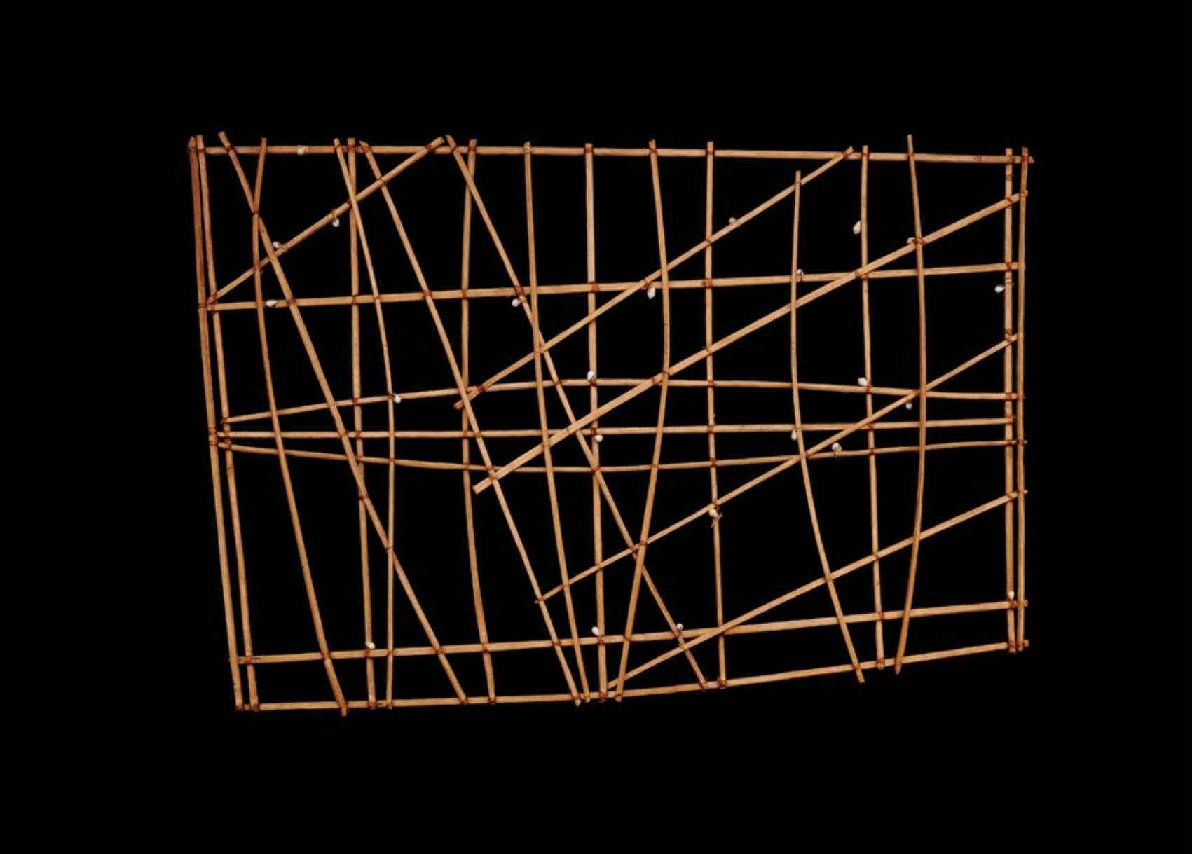
 Navigation chart © The Trustees of the British Museum
Navigation chart
Marshall Islands, Micronesia. 19th to early 20th century C.E. Wood and fiber.
Curator Note
"GPS of the ancients. This is not a literal map of land, but a map of water physics. It maps the swells and wave patterns caused by islands. Navigators (ri-metos) memorized these on land by feeling the sticks, then navigated the open ocean by feeling the water disruption under their canoe."
Form
- Material: Coconut midribs (sticks) tied together with fiber.
- Shells: Cowrie shells attached to represent island positions.
- Structure: Abstract geometric grid/lattice.
- Types: Mattang (training), Meddo (sub-regions), Rebbelib (large area).
- Durability: Lightweight and buoyant.
Function
- Educational Tool: Used on land to teach novices how to read waves.
- Mnemonic Device: Used by masters to refresh memory before a voyage.
- Not taken to sea: It was too fragile and unnecessary once memorized.
- Survival: Critical for finding tiny atolls in the vast Pacific.
- Secret Knowledge: Navigation was a guarded secret of the chiefly class.
Content
- Stick Intersections: Represent the interaction of different wave swells.
- Curved sticks: Represent the way waves "bend" (refract/diffract) around islands.
- Shells: Represent islands (but relative position, not exact GPS coords).
- Diagonal lines: Indicate wind and swell directions.
- Empty space: The open ocean.
Context
- Marshall Islands: Low-lying atolls hard to see until close; wave reading is essential.
- Wave Piloting: Reading the "reflection" of waves off land masses.
- Oral Tradition: Knowledge passed father to son.
- Technology shift: Use declined with European charts/GPS.
- Identity: Symbol of Marshallese ingenuity.